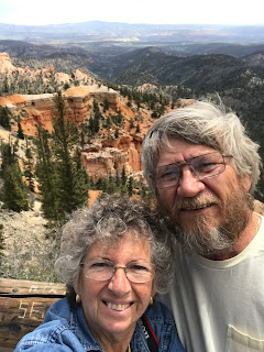
We overslept this morning 😔 We were hoping to leave for the national park around 8 am, but we did not leave until 9:15 am.
Because it is a long drive to go to one of the national parks we got gas fill-up while in Kanab, UT.
At that time I had not decided which national park for us to visit today, so I asked Erwin which one he would rather visit. His answer was “Bryce”. I asked him why and he replied that he had heard it is much prettier than Zion”. Ok, off to Bryce we went.
We got on Highway 89 (Scenic Byway), drove through several towns until we reached Hatch where we spotted a novelty chair and an unique homemade RV. They were on display at Tony’s Outpost/Food Mart. They were across from Galaxy Diner.
We got on the most famous highway - Scenic Byway 12/All America Road. The length is 122.9 miles one way. It starts near Torrey, UT (east end) and ends at Panguitch (west end) with the junction of State Route 63 to Bryce Canyon National Park.
We pulled over to the scenic pullout to enjoy the view of the Red Canyon. There is a large collection of vermilion-colored formations. There are trailheads, but we chose not to hike there. There are two short tunnels along the route. The clearance is 13’ 6”.
To go to Bryce Canyon you take SR-63 from Scenic Byway 12. It was about 4 miles before we came to the ranger station. The entrance fee for each vehicle is $30 (used to be $25), but we had Eagle Pass, so we went in for free.
Bryce Canyon National Park was established in February 25, 1928. It covers 35,835 acres. It opens every day except Thanksgiving, Christmas and New Year. The uniqueness of Bryce Canyon is the geological structures that were formed by different effects, such as frost, water stream, etc.. The park road follows the rim for 18 miles. There are over 65 miles of hiking trails.
We decided against leaving the Jeep at shuttle lot to take the shuttle bus to the canyons. We were not sure if we were going to have trouble finding parking spaces at viewpoints, but took risk and continued driving.
First viewpoint is at Sunset Point, but the parking lot was really FULL! We waited a while hoping that people would come back after viewing the canyons, but it was a long wait. We left to go to another viewpoint.
 |
| Natural Bridge |
The same scenery looked entirely different from each viewpoint. It was fantastic to see unusual formations and colors.
It started to sprinkle, then rained some, then came the sleet, but all those did not last very long. Yes, it was very very windy all morning long. At one place the wind was so strong that it blew the sand all over.
We had lunch at one of viewpoints, Ponderosa Point. The temperature dropped about 12˚ from the time we entered Bryce Canyon National Park.
On our way out of Bryce Canyon we decided to check Sunset Point, and there were parking spots available. We like the viewpoint so much. The next viewpoint we liked is Bryce Point.
~~Edith


No comments:
Post a Comment